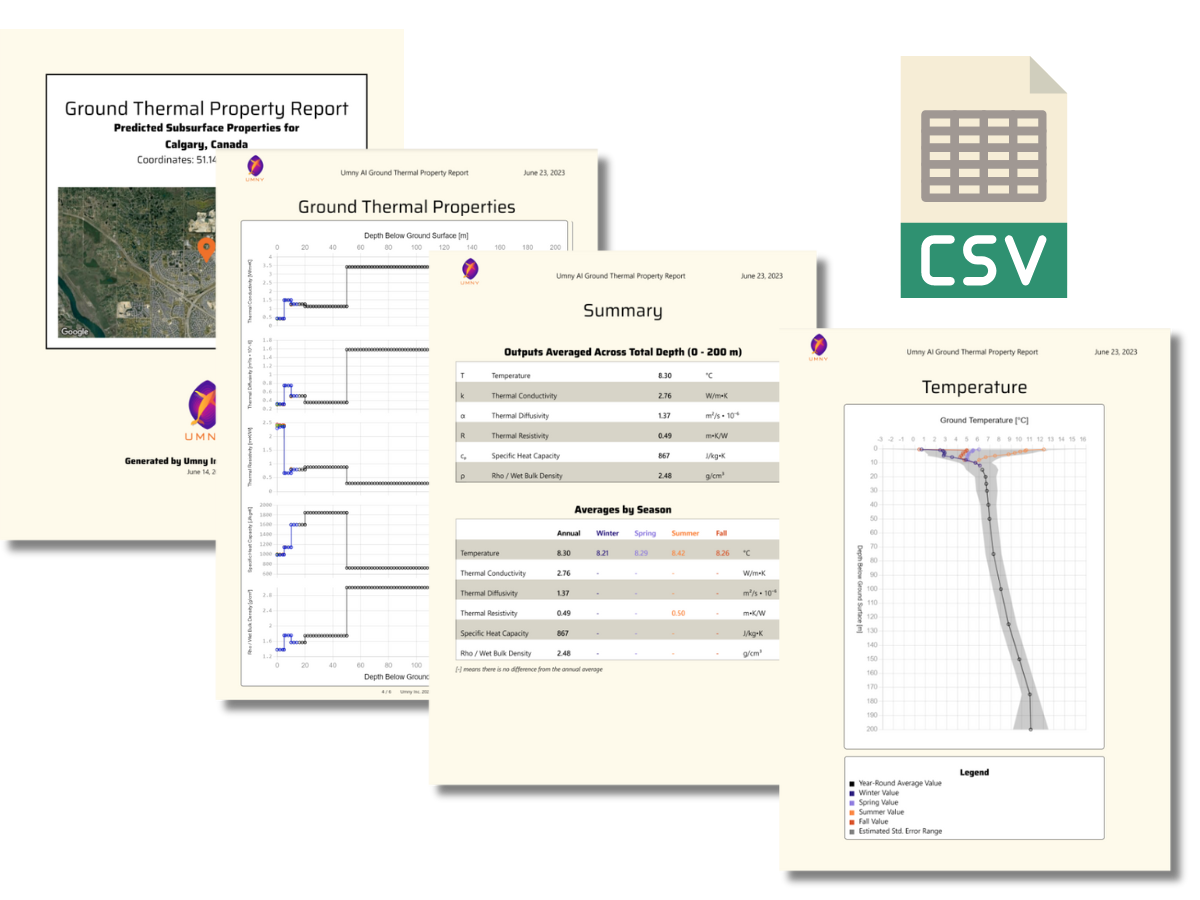
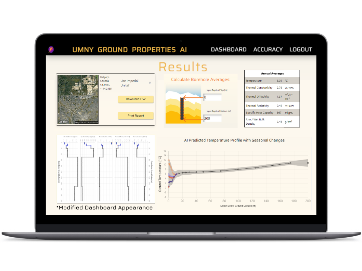
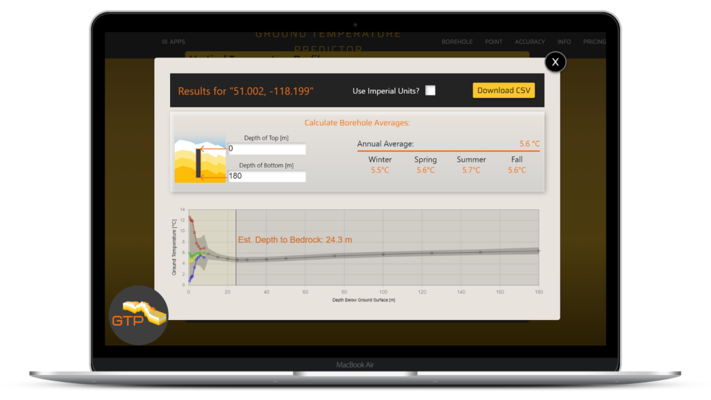
Access the Umny App to predict the ground thermal profile of a site or area.
We build predictive models from our database of real measurements from around the world. Giving you thermal properties with greater accuracy than interpolation or calculation, and far less cost and time than a drill test.
Speed
Accuracy
Cost
Use interpolation or calculations to estimate the thermal profile.
Spend precious hours finding the equation inputs for each site – especially in new areas. Unfortunately, these methods oversimplify the ground leading to errors in predictions that change the number and depth of boreholes – leading to excessive costs or undersizing.
Speed
Accuracy
Cost
Get a drill rig on site to perform a thermal property ("TRT") test.
After waiting to get a driller on site (could be months to book), this test typically costs $50,000 and requires hours to days of careful data collection for useful results. Adding this cost and wait upfront can stall a project before it even begins, along with the added costs for feasibility.
Speed
Accuracy
Cost
Find your Geothermal Feasibility
Helping you answer the question: "Would geo work here?"
All you need to get started are your project coordinates.
They’ve built easy-to-use software to help us solve our unique technical problems extremely efficiently. These tools have provided us value by helping us evaluate projects efficiently and at a lower cost than other alternatives. I look forward to our continued work with Umny.”
– Andrew Lee, P.Eng., President at Innovia GEO Corp.
Our products are shaped by our users and partners:
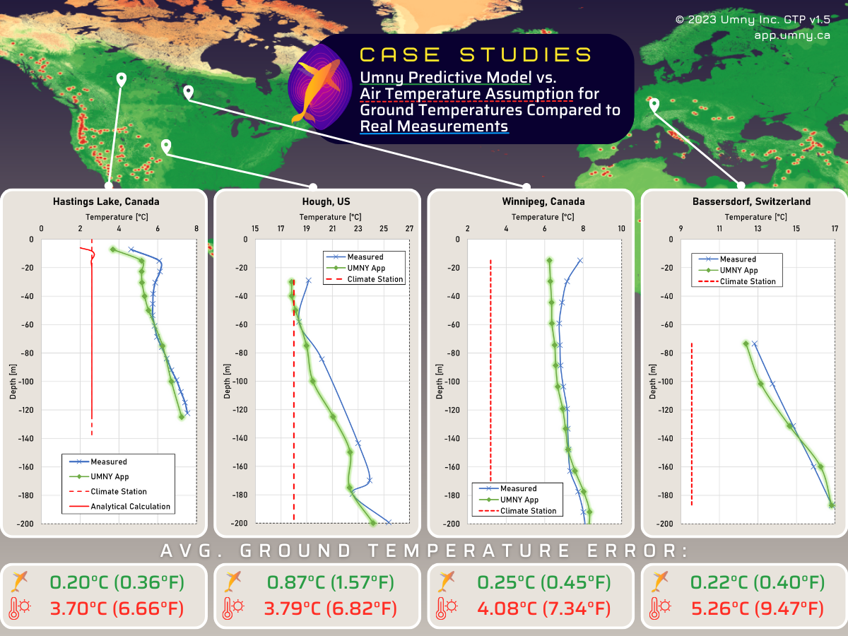
Without the time or money to pay for a drilling test, many people rely on analytical calculations (red line in chart) or an average air temperature assumption (red dashed line in chart) to find ground temperature.
But, real-world measurements (blue line in chart) show that the ground temperature can be far different from either of these two estimates. Our accurate predictions (green line in chart) are built from a database of real-world measurements, so they get you much closer to reality.
This means you can start a project with the right ground properties, with far less time or cost than other methods.
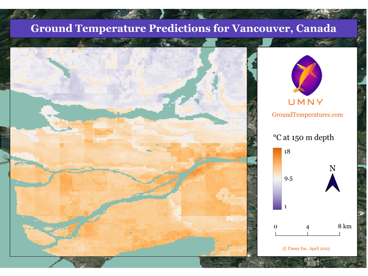
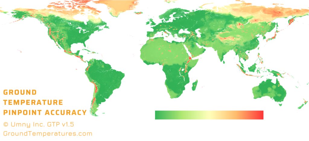
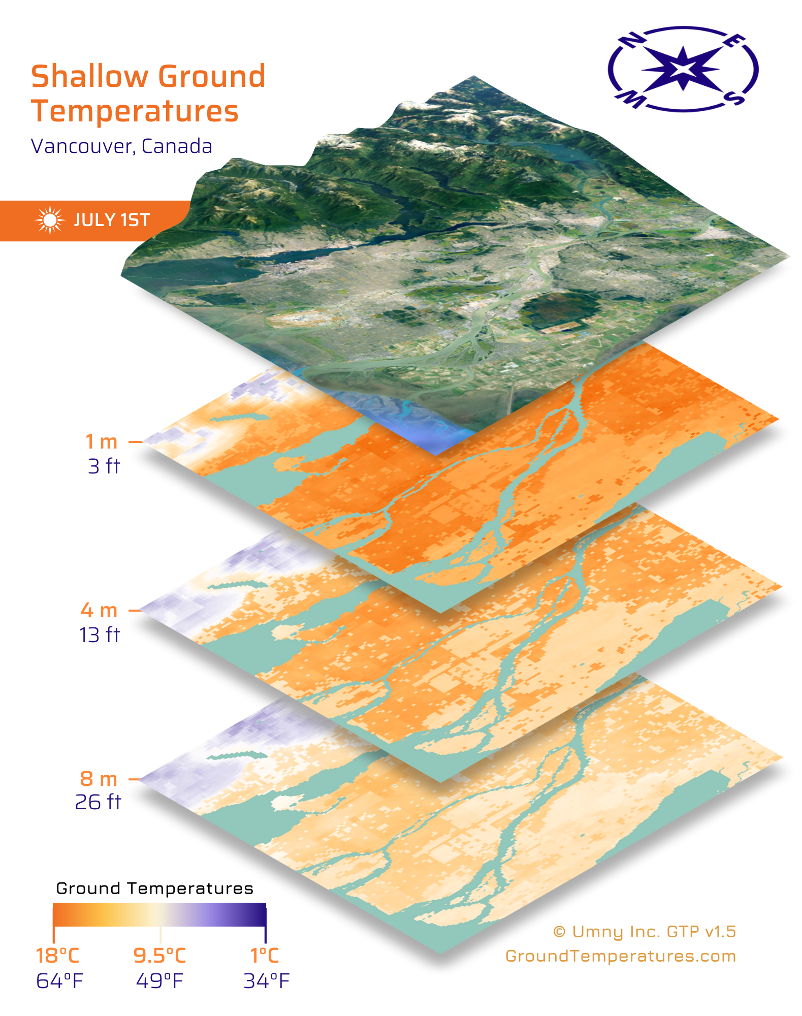
The ground is a key component in our global energy and environmental system, but it is still not well understood.
We addressed this problem by developing a highly accurate Ground Temperature Prediction App. This app uses novel machine learning techniques to capture global variations and predict the temperature of the ground at a certain depth, location, and date.
This app integrates with our other services and software to provide key variables to improve the accuracy of modeling, and can be used as a novelpredictor to help people in all fields and purposes better understand the land we all work on.
We strive to work smart, and to have a positive impact on the future, which is why we chose the whale to represent our company.
Whales are not only physically giants, they are also the giants of our global environment.
They are the keystone in the ocean’s nutrient cycling: counteracting gravity’s constant tendency to concentrate nutrients at the bottom of the ocean where they are un-useable by most life forms.
Additionally, their genus includes some of the most intelligent animals on the planet; with various species having brains up to 5 times larger than our own, and other species having brains more complex in structure than our own, or with more developed prefrontal cortexes.
Energy from Nature
with Geo-Exchange
We specialize in research and software tools for those who are designing, building, and operating geo-exchange and shallow geothermal systems.
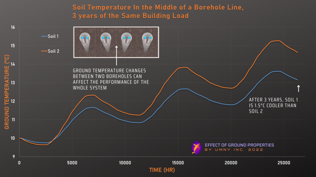
This article quantifies the effects on the efficiency, performance, and energy cost of in-ground heat exchangers from fluid temperatures that are commonly ignored.
The ground is a key component in our global energy and environmental system, but it is still not well understood.
The diversity of the soil’s characteristics make it difficult to generalize using typical calculation methods, and most technology that is built from these methods is designed with many assumptions.
We addressed this problem by developing a highly accurate Ground Temperature Prediction App. This app uses novel machine learning techniques to capture global variations and predict the temperature of the ground at a certain depth, location, and date.
In the field of ground-source heat pumps, and geoscience:
Our app out performed traditional ground temperature calculation methods by 200%, and generated results with 1/100th of the cost.
This app integrates with our other services and software to provide key variables to improve the accuracy of modeling, and can be used as a novelpredictor to help people in all fields and purposes better understand the land we all work on.
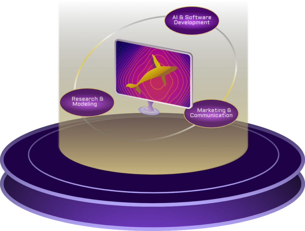
We are software developers and researchers with backgrounds in engineering, construction & trades, and environmental regeneration.
It is deeply important to our team at Umny Inc. that we develop enterprise software products and consulting services that meet real-world needs. Our diverse backgrounds give us the skills to solve problems with truly creative solutions.
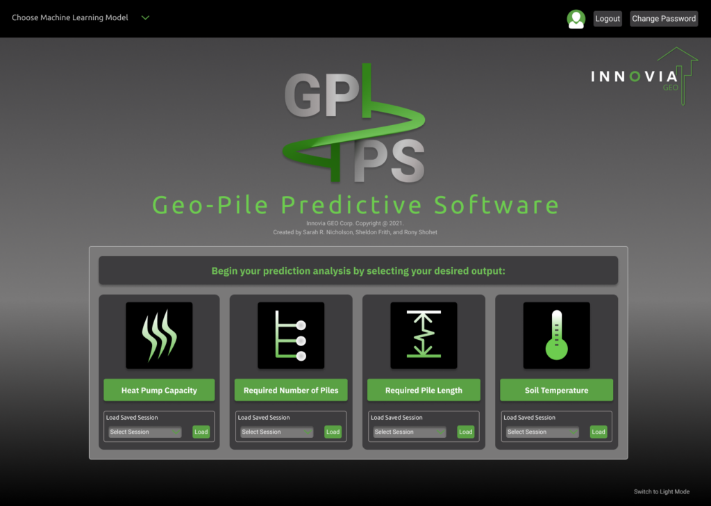
Predictive Software for a Novel Geothermal System:
This software enabled our client to…
Novel Systems & Technology
Commercialization & Adoption
Sustainable Housing & Energy
Benefits of Machine Learning:
We integrate physics-based modeling with ML tools to tackle energy problems with physical processes that are not fully understood by engineers and scientists, but for which data of adequate quality and quantity is available.
We are software developers and researchers with backgrounds in engineering, construction & trades, and environmental regeneration.
It is deeply important to our team at Umny Inc. that we develop solutions that meet real-world needs. Our diverse backgrounds give us the skills to solve problems with truly creative solutions.